![]()
![]()
Home ![]() Pre Katrina Home
Pre Katrina Home ![]() Orleans Parish
Orleans Parish ![]() Algiers District
Algiers District ![]() McDonogh
McDonogh
This information is pre-Katrina. For current data about New Orleans and its neighborhoods, visit our homepage. |
McDonogh Neighborhood
“Irish, Italian and German immigrants were the first New Orleanians to populate McDonogh in the late 19th and early 20th centuries. The city's robust economic growth from trade increased population and immigrants fled to the West bank to relieve the increasingly crowded East bank. Excellent ferry service to the East bank's Faubourg St. Mary (now the CBD), Vieux Carre, and Marigny neighborhoods facilitated the growth of this neighborhood during this period.” [Read more in the Neighborhood Snapshot]
Street map with links
to nearby neighborhoods: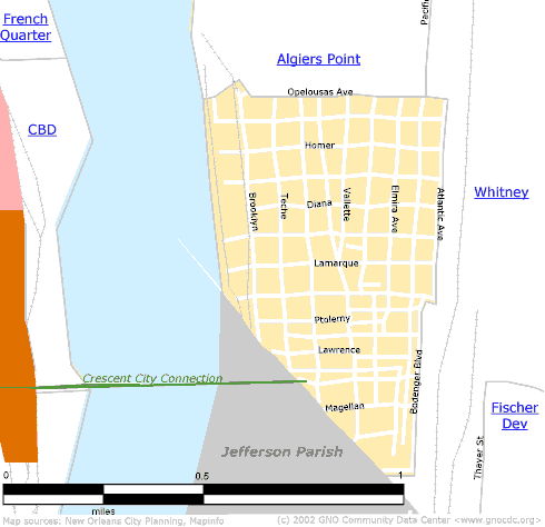
| [ Census tract and zip code boundary maps ] |
Census 2000 Data Tables: People & Household Characteristics, Housing & Housing Costs, Income & Poverty, Transportation, Employment, Educational Attainment, Immigration & Language, Disabilities, Neighborhood Characteristics
Home ![]() Pre Katrina Home
Pre Katrina Home ![]() Orleans Parish
Orleans Parish ![]() Algiers District
Algiers District ![]() McDonogh
McDonogh
![]()
|
The Community Data Center website is a product of Greater New Orleans Nonprofit Knowledge Works. Copyright © 2000-2. All Rights Reserved. Last modified: April 23, 2002 |