![]()
![]()
Home ![]() Pre Katrina Home
Pre Katrina Home ![]() Orleans Parish
Orleans Parish ![]() Algiers District
Algiers District ![]() Behrman
Behrman
This information is pre-Katrina. For current data about New Orleans and its neighborhoods, visit our homepage. |
Behrman Neighborhood
“This inland West bank neighborhood named after a popular New Orleans mayor is nestled south of the US Naval Support neighborhood and north of Tall Timbers/Brechtel, flanked on the west by Fischer Housing Development and Whitney, and on the east by Old Aurora. The neighborhood is predominately African American, with 77.4% of residents identifying as such in the 2000 Census. However, Behrman also has the second largest Hispanic population (6.6%) of Orleans Parish neighborhoods (Census 2000).” [Read more in the Neighborhood Snapshot]
Street map with links
to nearby neighborhoods: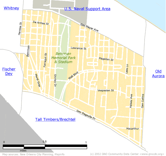
| [ Census tract and zip code boundary maps ] |
Census 2000 Data Tables: People & Household Characteristics, Housing & Housing Costs, Income & Poverty, Transportation, Employment, Educational Attainment, Immigration & Language, Disabilities, Neighborhood Characteristics
Home ![]() Pre Katrina Home
Pre Katrina Home ![]() Orleans Parish
Orleans Parish ![]() Algiers District
Algiers District ![]() Behrman
Behrman
![]()
|
The Community Data Center website is a product of Greater New Orleans Nonprofit Knowledge Works. Copyright © 2000-2. All Rights Reserved. Last modified: October 8, 2002 |