![]()
![]()
Home ![]() Pre Katrina Home
Pre Katrina Home ![]() Orleans Parish
Orleans Parish ![]() New Aurora/English Turn District
New Aurora/English Turn District
This information is pre-Katrina. |
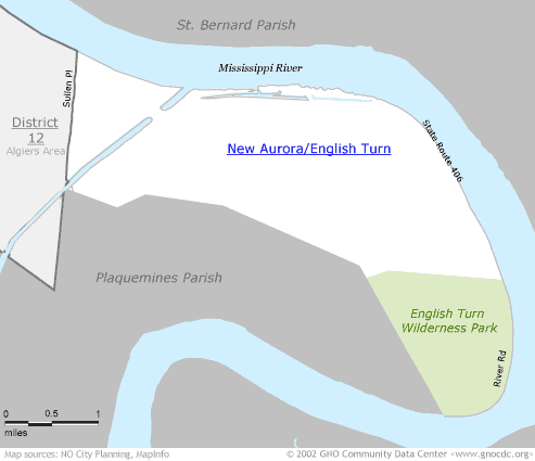
New Aurora – is it in Planning District 12 or 13? The small triangle of land generally known as New Aurora (just west of the Intercoastal Waterway) is a separate Census tract that is sometimes included in the Old Aurora neighborhood in District 12, and other times included in with English Turn in District 13. Neighborhood health data published on this web site was gathered in 1998, based on boundaries then in place at NO City Planning. Those boundaries differ from the current planning boundaries used by NOCP. To allow for easier comparison of data, we have kept the 1998 boundaries, which have New Aurora and English Turn being in the same neighborhood. If your service area includes New Aurora in with Old Aurora, contact us for help in getting data for that geography. You can do so by filling out this Technical Assistance Request form. |
|
About neighborhood boundaries: We've chosen the neighborhood boundaries on this web site to organize and present data. They may not match the boundaries of neighborhood associations, redevelopment corridors, commercial subdivisions, planning efforts, or historic districts. Learn more about how we chose these boundaries... |
|
New Aurora/English Turn District (Planning District 13)
Click on a neighborhood below to see 2000 Census data about it...
Home ![]() Pre Katrina Home
Pre Katrina Home ![]() Orleans Parish
Orleans Parish ![]() New Aurora/English Turn District
New Aurora/English Turn District
![]()
The Community Data Center website is a product of Greater New Orleans Nonprofit Knowledge Works. Copyright © 2000-2. All Rights Reserved. Last modified: October 4, 2002 |