![]()
![]()
Home ![]() Pre Katrina Home
Pre Katrina Home ![]() Orleans Parish
Orleans Parish ![]() Uptown/ Carrollton District
Uptown/ Carrollton District ![]() East
Carrollton
East
Carrollton
This information is pre-Katrina. For current data about New Orleans and its neighborhoods, visit our homepage. |
East Carrollton Neighborhood
“In 1875, the annexed territory known as East Carrollton provided New Orleanians with the benefit of a rural atmosphere, access to the city and economic advantage. Wealthy families built suburban mansions along St. Charles Avenue in the present East Carrollton neighborhood. By the late nineteenth century, most development in East Carrollton had occurred. It remains stable and no significant land use changes have taken place. It is predominated by single family, two family and multi-family residences.” [Read more in the Neighborhood Snapshot]
Street map with links
to nearby neighborhoods: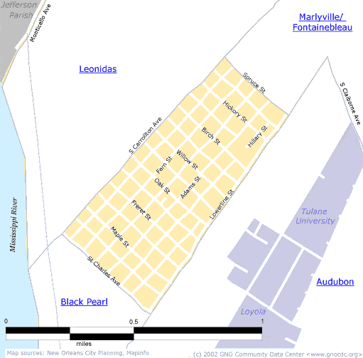
| [ Census tract and zip code boundary maps ] |
Census 2000 Data Tables: People & Household Characteristics, Housing & Housing Costs, Income & Poverty, Transportation, Employment, Educational Attainment, Immigration & Language, Disabilities, Neighborhood Characteristics
Home ![]() Pre Katrina Home
Pre Katrina Home ![]() Orleans Parish
Orleans Parish ![]() Uptown/ Carrollton District
Uptown/ Carrollton District ![]() East
Carrollton
East
Carrollton
![]()
|
The Community Data Center website is a product of Greater New Orleans Nonprofit Knowledge Works. Copyright © 2000-2. All Rights Reserved. Last modified: April 23, 2002 |