![]()
![]()
Home ![]() Pre Katrina Home
Pre Katrina Home ![]() Orleans Parish
Orleans Parish ![]() Mid-City District
Mid-City District ![]() St. Bernard
Area
St. Bernard
Area
This information is pre-Katrina. For current data about New Orleans and its neighborhoods, visit our homepage. |
St. Bernard Area Neighborhood
“The St. Bernard Area's borders stretch from Harrison Avenue to Southern Railway and from Bayou St. John to Paris Avenue. It is home to several housing efforts and a community development center. In recent years, many housing developments in New Orleans have undergone renovations. The numbers from the 2000 Census for this neighborhood may no longer be accurate. Please check with the Housing Authority of New Orleans and the St. Bernard Resident Council for the most current status of the development.” [Read more in the Neighborhood Snapshot]
Street map with links
to nearby neighborhoods: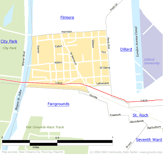
| [ Census tract and zip code boundary maps ] |
Census 2000 Data Tables: People & Household Characteristics, Housing & Housing Costs, Income & Poverty, Transportation, Employment, Educational Attainment, Immigration & Language, Disabilities, Neighborhood Characteristics
Home ![]() Pre Katrina Home
Pre Katrina Home ![]() Orleans Parish
Orleans Parish ![]() Mid-City District
Mid-City District ![]() St. Bernard
Area
St. Bernard
Area
![]()
|
The Community Data Center website is a product of Greater New Orleans Nonprofit Knowledge Works. Copyright © 2000-2. All Rights Reserved. Last modified: April 23, 2002 |