![]()
![]()
Home ![]() Pre Katrina Home
Pre Katrina Home ![]() Orleans Parish
Orleans Parish ![]() Uptown/ Carrollton District
Uptown/ Carrollton District ![]() Leonidas
Leonidas
This information is pre-Katrina. For current data about New Orleans and its neighborhoods, visit our homepage. |
Leonidas Neighborhood
“A large and diverse section of New Orleans, made up of 4 distinct census tracts, bounded by the touristy River Bend area on one end and the levee on the Jefferson Parish line, Leonidas (a.k.a. West Carrollton) is home to almost 9,000 New Orleans residents (Census 2000).” [Read more in the Neighborhood Snapshot]
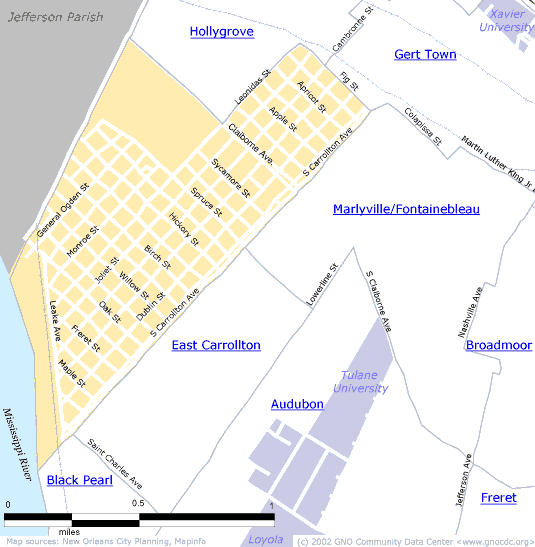
Street map with links
to nearby neighborhoods:
| [ Census tract and zip code boundary maps ] |
Census 2000 Data Tables: People & Household Characteristics, Housing & Housing Costs, Income & Poverty, Transportation, Employment, Educational Attainment, Immigration & Language, Disabilities, Neighborhood Characteristics
Home ![]() Pre Katrina Home
Pre Katrina Home ![]() Orleans Parish
Orleans Parish ![]() Uptown/ Carrollton District
Uptown/ Carrollton District ![]() Leonidas
Leonidas
![]()
|
The Community Data Center website is a product of Greater New Orleans Nonprofit Knowledge Works. Copyright © 2000-2. All Rights Reserved. Last modified: April 23, 2002 |