![]()
![]()
Home ![]() Pre Katrina Home
Pre Katrina Home ![]() Orleans Parish
Orleans Parish ![]() Mid-City District
Mid-City District ![]() Tremé/
Lafitte
Tremé/
Lafitte
This information is pre-Katrina. For current data about New Orleans and its neighborhoods, visit our homepage. |
Tremé/ Lafitte Neighborhood
“In the 1800s, Tremé was a prosperous, ethnically diverse community. In the 1960s, the Tremé’s thriving African American business district along Claiborne Avenue was destroyed to make way for the new I-10 interstate loop. With many long-time residents, Tremé is still an incredibly rich community with tremendous cultural roots and an amazing ability to persevere.” [Read more in the Neighborhood Snapshot]
Street map with links
to nearby neighborhoods: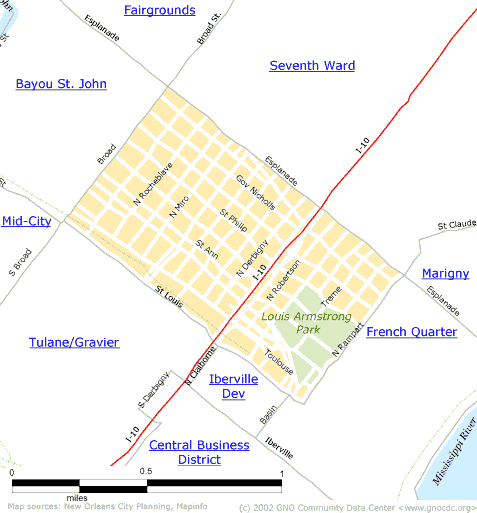
| [ Census tract and zip code boundary maps ] |
Census 2000 Data Tables: People & Household Characteristics, Housing & Housing Costs, Income & Poverty, Transportation, Employment, Educational Attainment, Immigration & Language, Disabilities, Neighborhood Characteristics
Home ![]() Pre Katrina Home
Pre Katrina Home ![]() Orleans Parish
Orleans Parish ![]() Mid-City District
Mid-City District ![]() Tremé/
Lafitte
Tremé/
Lafitte
![]()
|
The Community Data Center website is a product of Greater New Orleans Nonprofit Knowledge Works. Copyright © 2000-2. All Rights Reserved. Last modified: April 23, 2002 |