![]()
![]()
Home ![]() Pre Katrina Home
Pre Katrina Home ![]() Orleans Parish
Orleans Parish ![]() New Orleans East District
New Orleans East District ![]() Viavant/
Venetian Isles
Viavant/
Venetian Isles
This information is pre-Katrina. For current data about New Orleans and its neighborhoods, visit our homepage. |
Viavant/ Venetian Isles Neighborhood
“The Viavant /Venetian Isles neighborhood is home to significant manufacturing and training facilities in New Orleans. Together with the adjacent Lake Catherine neighborhood it represents the largest tract of predominantly uninhabited land within the boundaries of the city of New Orleans. ” [Read more in the Neighborhood Snapshot]
Street map with links
to nearby neighborhoods: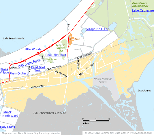
| [ Census tract and zip code boundary maps ] |
Census 2000 Data Tables: People & Household Characteristics, Housing & Housing Costs, Income & Poverty, Transportation, Employment, Educational Attainment, Immigration & Language, Disabilities, Neighborhood Characteristics
Home ![]() Pre Katrina Home
Pre Katrina Home ![]() Orleans Parish
Orleans Parish ![]() New Orleans East District
New Orleans East District ![]() Viavant/
Venetian Isles
Viavant/
Venetian Isles
![]()
|
The Community Data Center website is a product of Greater New Orleans Nonprofit Knowledge Works. Copyright © 2000-2. All Rights Reserved. Last modified: April 23, 2002 |