![]()
![]()
Home ![]() Pre Katrina Home
Pre Katrina Home ![]() Orleans Parish
Orleans Parish ![]() New Orleans East Area
New Orleans East Area
This information is pre-Katrina. |
New Orleans East The Lake Catherine neigbhorhood is made up of a single Census tract – which is why we decided to keep this area as a single neighborhood rather than the 3 designated by City Planning. Note that Bayou Savage National Refuge takes up most of the Lake Catherine neighborhood. |
|
About neighborhood boundaries: We've chosen the neighborhood boundaries on this web site to organize and present data. They may not match the boundaries of neighborhood associations, redevelopment corridors, commercial subdivisions, planning efforts, or historic districts. Learn more about how we chose these boundaries... |
|
New Orleans East Area (Planning District 11)
Click on a neighborhood below to see 2000 Census data about it... 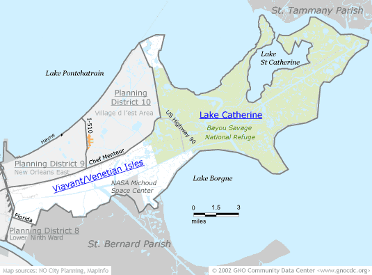
![]()
The Community Data Center website is a product of Greater New Orleans Nonprofit Knowledge Works. Copyright © 2000-2. All Rights Reserved. Last modified: October 4, 2002 |